CALPUFF View
Puff Air Dispersion Model
CALPUFF View provides a complete graphical solution for the CALPUFF modeling system: CALPUFF, CALMET, CALPOST, and their related pre- and post-processors. All three modeling systems are supported by the interface:
- USEPA Approved Version 5.8
- Version 6
- Version 7
CALPUFF View includes powerful and independent QA tools, stunning report-ready results, and a wide range of visualization options.
CALPUFF is a sophisticated model and is used in many modeling scenarios including:
- Toxic pollutant deposition
- Complex terrain
- Long range and overwater transport
- Costal interaction effects
- Fumigation conditions
- Sub-hourly time steps
- Visibility assessments
- Secondary pollutant formation
- Building downwash
- Dry deposition
- Chemical transformation
About CALPUFF
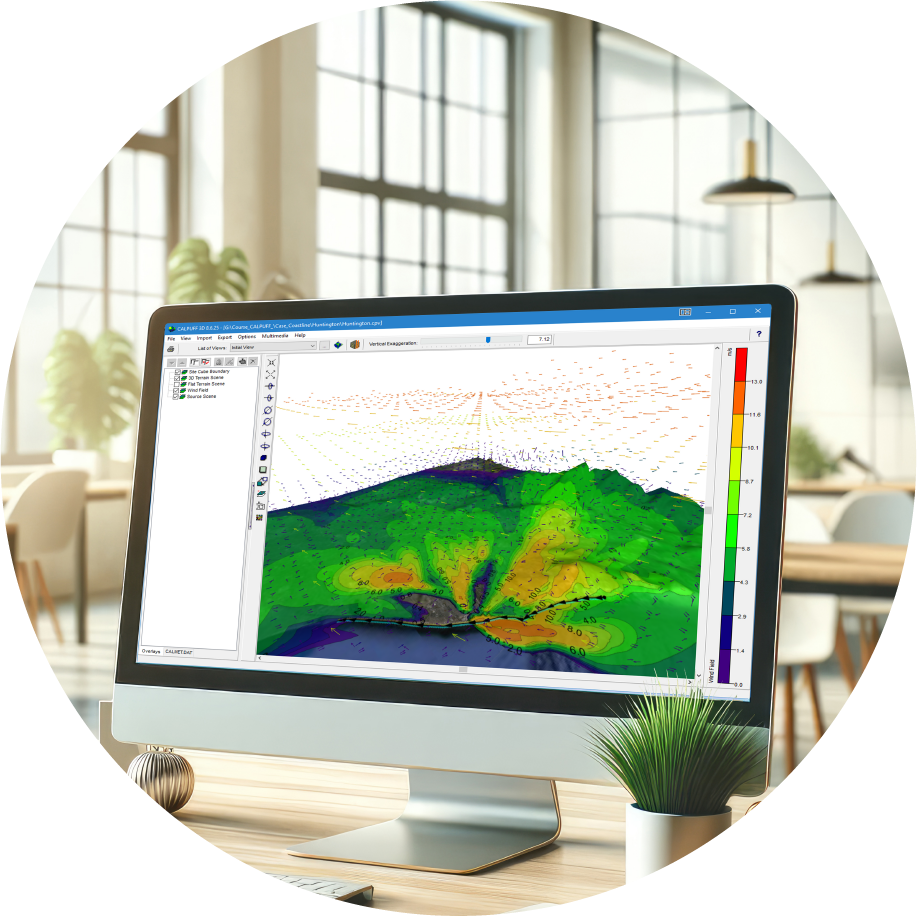
CALPUFF is a multi-layer, multi-species non-steady-state puff dispersion model which simulates the effects of time-and space-varying meteorological conditions on pollution transport, transformation, and removal. The CALPUFF modeling system includes:
- CALMET – Diagnostic three-dimensional meteorological model
- CALPUFF – The puff dispersion model
- CALPOST – Post-processor for calculating time-averaged concentrations, deposition fluxes, and visibility impacts
Why CALPUFF
- CALPUFF can be applied to a wide variety of scenarios including far-field impacts (those beyond 50km from releases) which cannot be modeled with traditional plume models (e.g., AERMOD).
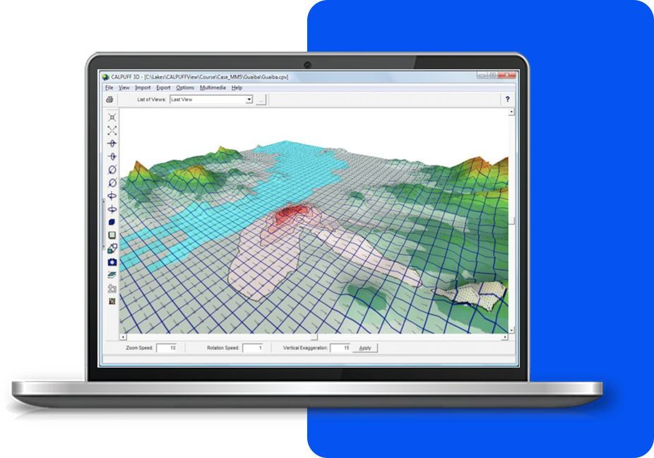
- Its three-dimensionally varying meteorological field makes it useful for regions with very complex terrain or non-steady-state conditions.
- CALPUFF View’s wide range of features make it easy to execute the entire suite of pre- and post-processors for a modeling analysis.
CALPUFF View Key Features
CALPUFF View is impeccably designed to streamline all aspects of model setup, execution, and analysis. Air dispersion modeling has never been easier.
Parallel CALMET
Utilize multiple cores when running the CALMET model to generate model data faster than ever.
Google Earth Export
Export your buildings, sources, receptors and contours into Google Earth.
Tile Maps
Automatically download and import high-resolution satellite and street map imagery into your projects.
PUFF Tracking
Easily see where your puff will impact. The play feature shows how your puff disperses over time.
Plume Animation
Allows you to play and record plume animations along with your wind field.
Terrain Data
Advanced terrain processing capabilities are offered for several terrain data file formats.
Empowering Air Quality Professionals with
an All-in-One Software Package
We’re here to make things easy! Here’s a list of everything included with your software purchase:
Software Updates
Technical Support and Resources
Popular Features
System Requirements
Our products are Microsoft Windows-based programs that can be installed in the following Windows operating systems:
- 32-bit and 64-bit Operating Systems
- Windows 10 or 11
Minimum Requirements:
- 1 GHz or faster processor
- At least 20 GB of available hard disk space
- 2 GB of RAM (4 GB recommended)
Met Data
CALPUFF.org

Training
Custom IT Solutions

Advanced Technologies for Unique Solutions
Lakes Environmental provides a wide variety of software products in the areas of air dispersion modeling, human health and ecological risk assessment, emissions inventory, compliance, as well as emergency release.
- Advanced Air Pollutant Modeling
- Expert Health & Ecological Risk Analysis
- Comprehensive Emissions Reporting
- Rapid Environmental Emergency Mitigation
CALPUFF View Software and Maintenance
CALPUFF View
- 1 Year Access to Maintenance/Technical Support
- 1 Year Access to Software Updates
- Automatic Download of Tile Maps
- Automatic Download of NED Terrain Data
- User's Guides and Manuals
CALPUFF View Maintenance
- Software Updates
- Technical Support
- Automatic Download of Tile Maps
- Automatic Download of NED Terrain Data
- User's Guides and Manuals
What our Clients are Saying About Us
I have started using CALRoads View and I am very impressed with the way it operates. It is user friendly and has the right tools – great product and customer service!
M.A. – NEW YORK, USA
Lakes’ automated quotation system and quick personalized responses to all queries, makes acquiring good quality meteorological data effortless. The support team is very helpful and always willing to assist promptly.
H.L - HALFWAY HOUSE, SOUTH AFRICA
Excellent instructor. Michael is clearly in his comfort zone when teaching a difficult subject. He incorporates just the right amount of levity, which adds to the enjoyment of the course.
M.C - SAN FRANCISCO, USA
Your software made modeling efforts easier. The contour plots and base maps were very nice. Importing DEM data was seamless. Your Tech Support team has been very helpful.
R.H - ANNAPOLIS, USA
I am really happy with the services and the level of professionalism from your staff members. The turnaround time is really good.