AUSTAL View
Lagrangian Particle Tracking Air Dispersion Model
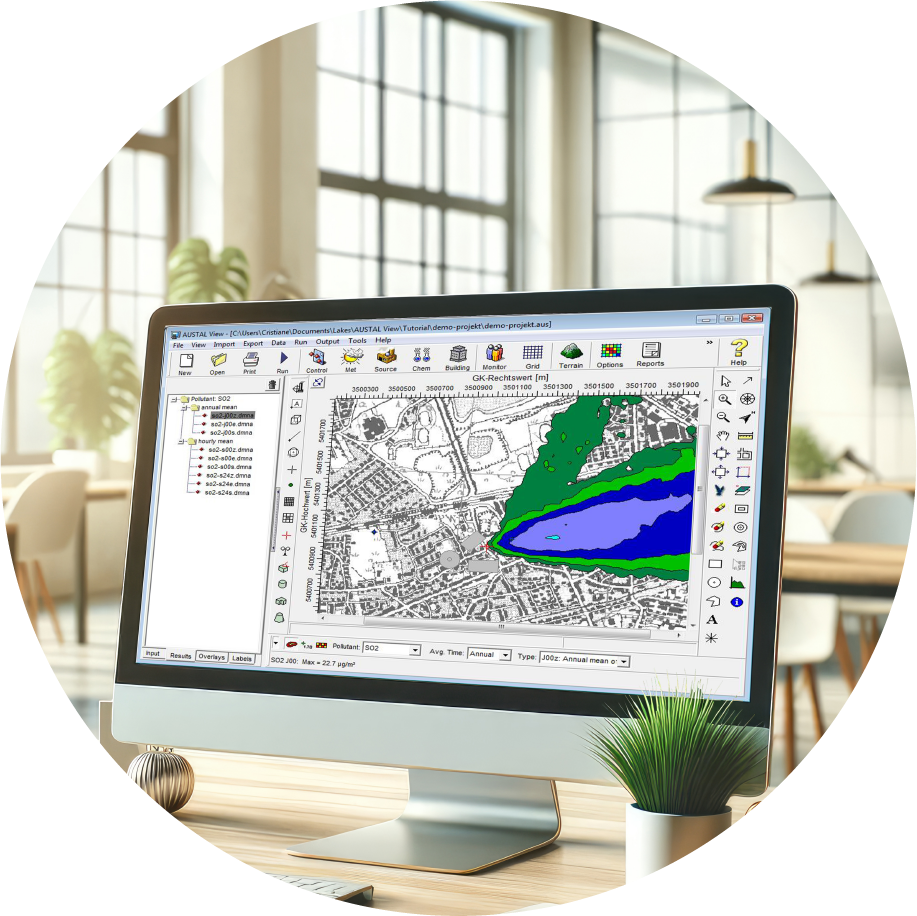
AUSTAL View is a graphical user interface for the official German Federal Environmental Agency air dispersion model, AUSTAL.
The AUSTAL model was developed according to Germany's air pollution control regulation TA Luft (Technical Instructions on Air Quality).
AUSTAL is a Lagrangian particle tracking air dispersion model that contains its own diagnostic wind field model (TALdia). The model takes into account the influence of topography on the wind field and therefore on the dispersion of pollutants.
Available AUSTAL View Modules
AUSTAL View is available in three versions (T, G, and TG) and an add-on module. See descriptions below:
- AUSTAL View T: This version supports the TA Luft chemicals but does not support odor modeling (formerly AUSTAL View).
- AUSTAL View G: This version supports odor modeling but does not support the TA Luft chemicals (formerly ODOR View).
- AUSTAL View TG: This version supports all the TA Luft chemicals and odor modeling. This version combines the specialized AUSTAL View T and AUSTAL View G Versions (formerly AUSTAL View G+).
- Multi-Core Module: This module allows for the use of a multi-core (multi-processor) compatible model executable, and allows for the use of up to 8 multi-processors in a single machine.
AUSTAL View Key Features
AUSATAL View incorporates features designed by experienced meteorologists and engineers who routinely work with air dispersion models. This ensures it meets the practical needs of today's modelers for successful and efficient performance.
Integrated Interface
Fully integrated GIS-based interface combining easy to use graphical tools.
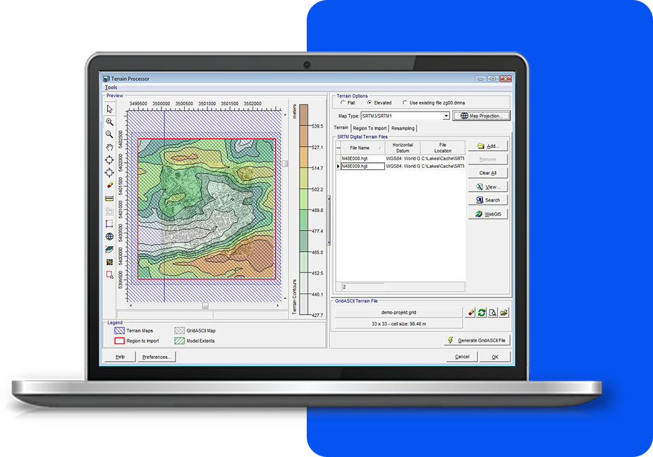
Terrain Data
Advanced terrain processing capabilities are offered for several terrain data file formats.
3D Visualization
Visualize your modeling area in 3D with sources, buildings, terrain, and custom building textures.
Base Maps
Allows you to design your model with confidence and view your results in context with your site.
Google Earth Export
Export your buildings, sources, receptors and contours into Google Earth.
Windrose Tool
Creates windrose plots in the following formats: AKT, AKTerm, AKS, series.dmna, zeitreihe.dmna.
Empowering Air Quality Professionals with
an All-in-One Software Package
We’re here to make things easy! Here’s a list of everything included with your software purchase:
Software Updates
Technical Support and Resources
Popular Features
System Requirements
Our products are Microsoft Windows-based programs that can be installed in the following Windows operating systems:
- 32-bit and 64-bit Operating Systems
- Windows 10 or 11
Minimum Requirements:
- An Intel Pentium 4 processor (or equivalent) or higher
- At least 2 GB of available hard disk space
- 1 GB of RAM (2 GB recommended)
AUSTAL View Software and Maintenance
AUSTAL View
- 1 Year Access to Maintenance/Technical Support
- 1 Year Access to Software Updates
- Automatic Download of Tile Maps
- User's Guides and Manuals
AUSTAL View Maintenance
- Software Updates
- Technical Support
- Automatic Download of Tile Maps
- User's Guides and Manuals