1-170 Columbia St. W

CALPUFF View Features

CALPUFF VIEW

Key Features

CALPUFF View is impeccably designed to streamline all aspects of model setup, execution, and analysis. Air dispersion modeling has never been easier.

Parallel CALMET

Enhance your processing efficiency with CALPUFF View! By utilizing multiple CPU cores, CALPUFF View significantly accelerates the computational speed of the CALMET model, allowing you to generate model data faster than ever before. This capability enables you to process large datasets more efficiently, reducing simulation time, especially for complex scenarios requiring high-resolution temporal and spatial inputs.

Lakes Tile Maps

Enhance your projects by automatically downloading and importing high-resolution satellite and street map imagery directly into your modeling projects. This feature simplifies the graphical input of model objects, such as sources, buildings, and receptors, by providing a highly detailed and accurate visual backdrop. The imported imagery serves as an excellent spatial reference point, allowing you to precisely position and define model elements within their real-world context.

Plume Animation

This exciting feature offers the ability to play and record dynamic plume animations in conjunction with your wind field data. By visualizing how plumes of pollutants disperse over time in sync with wind patterns, you can gain deeper insights into the behavior of airborne substances under varying meteorological conditions. The ability to record these animations provides an invaluable tool for presentations, reports, or further analysis, allowing you to capture key moments of plume movement and interaction with the wind field.

Export to Google Earth

This powerful feature enables you to export your buildings, emission sources, receptors, and pollutant contours directly into Google Earth. By doing so, you can visualize your data in a more immersive and realistic manner, providing a better understanding of how pollutants might disperse and affect the surrounding areas. This enhanced visualization tool not only aids in better assessing environmental impacts but also supports more informed decision-making by giving you a clearer picture of potential pollutant distribution across various geographic landscapes.

CALPUFF Google Earth Feature

Puff Tracking Animations in Google Earth

This feature offers a powerful way to visualize and analyze the impact area of your puff model in a real-world geographic context.  Quickly and easily see exactly where your pollutant plume will travel, disperse, and ultimately impact the surrounding environment. This feature allows you to overlay your puff dispersion data onto detailed satellite imagery, offering a highly accurate and visually intuitive representation of how pollution interacts with specific terrains, landscapes, and populated areas.

Auto Download of Terrain and Land Use Data

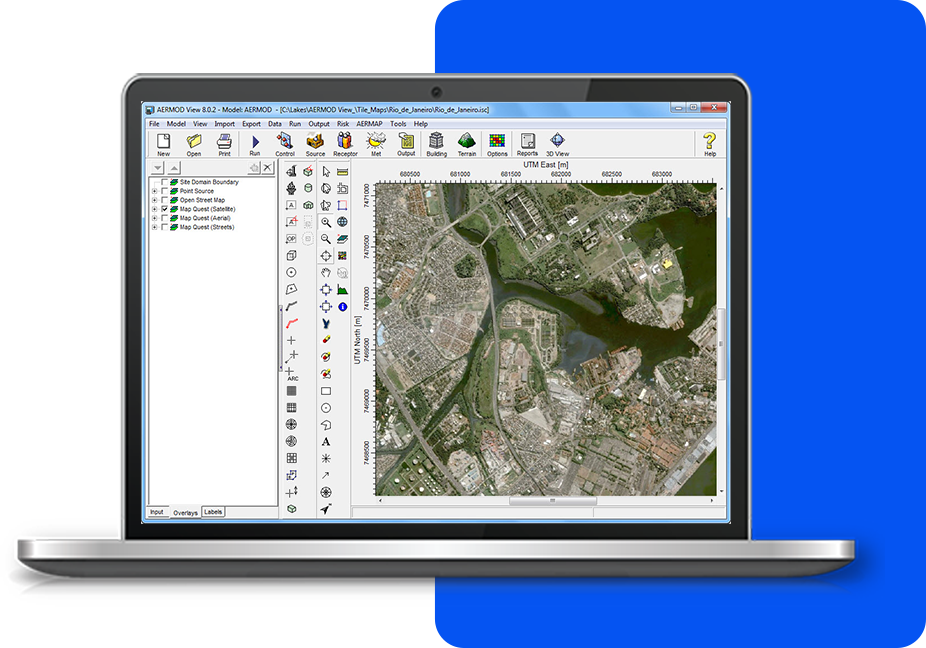
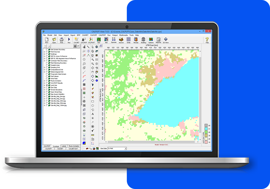
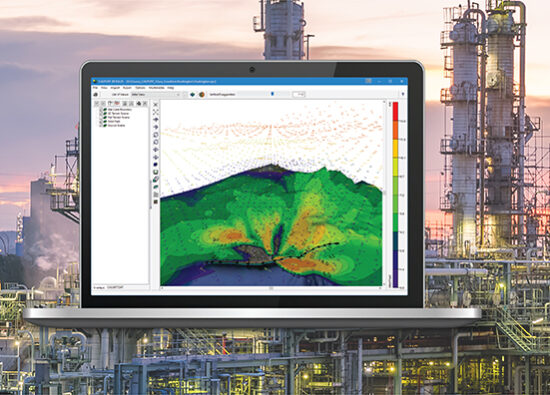
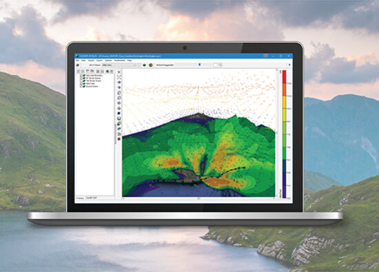
This feature offers advanced terrain processing capabilities, supporting various terrain data formats such as NED, SRTM, and USGS DEM, ensuring flexibility and accuracy in your environmental modeling. It includes an automated download feature for easy retrieval of terrain data from WebGIS and SRTM1 terrain data at 30 m resolution. This streamlines your workflow, minimizes manual effort, and provides valuable insights to terrain-related impacts.

CALPUFF Feature Terrain
CALPUFF VIEW

Additional Features

CALPUFF View offers more than just an intuitive interface. Every copy comes fully equipped with all the tools you need to complete your project—no need for expensive add-ons.

Met Pre-Processors

Seamlessly runs SMERGE, METSCAN, READ62, PXTRACT, and PMERGE for all of your met processing. Surface, Upper Air, and Precipitation files can be downloaded automatically from WebMET.

3D Visualization

Complete and powerful 3D visualization of your modeling area. Sources, buildings, wind field, and concentration/deposition contour results are displayed in context with the surrounding terrain.

CALPUFF Wizards

CALPUFF View provides an easy-to-use graphical interface. Each section can be completed by following the steps outlined in various wizards so that you don’t miss specifying required information.

Fully Integrated GUI

Combining easy to use graphical tools for drawing model objects; seamless model run execution; and automated contouring and posting of results.

Sloped Roof Tool

This utility allows users to automatically create multiple building tiers based on the defined top and bottom tier to create the appearance of a sloped roof.

Report Templates

Take advantage of the professional ready-to-use report templates. You can include your company logo, project number, and other project specific information.
CALPUFF VIEW

Modeling Tips

Unlock the full potential of your environmental software with expert guidance. These tips will help you streamline processes, improve accuracy, and maximize efficiency in every project.