1-170 Columbia St. W

CALRoads View Features

CALROADS VIEW

Key Features

CALRoads View is an industry-leading tool for modeling mobile sources, offering a comprehensive set of features that simplify the modeling process. Its user-friendly interface allows for quick and easy creation and execution of models, making it an essential tool for professionals.

Integrated Graphical User Interface

A fully integrated GIS-based interface with powerful, intuitive tools that simplify and enhance your environmental modeling. With easy-to-use graphical tools, you can precisely draw and define roadway links, and receptors, ensuring accurate mapping of your study area. It supports seamless model run execution, allowing for efficient data processing and automatically generates and posts detailed contours, providing clear and immediate insights into pollutant distribution.

Unlimited Receptors

CALRoads View provides the flexibility to run a project with an unlimited number of receptors. This feature allows you to configure your project with various receptor options, including a detailed Cartesian receptor grid for uniform coverage, specific discrete receptors for targeted analysis, and receptors placed strategically along roadways to capture traffic-related emissions. This level of customization ensures that you can model air quality impacts with greater precision, adapting to the specific needs of each project without the limitations of receptor count, giving you comprehensive control over your analysis.

Lakes Tile Maps

Seamlessly download and import high-resolution satellite and street map imagery directly into your projects with just a few clicks. This feature streamlines the graphical input of new road links and receptors, enhancing accuracy and efficiency. The imported imagery also serves as a precise spatial reference, helping you better visualize and analyze your model results with greater confidence.

Meteorological Scenarios

CALINE4: Allows you to specify the worst-case meteorological conditions for air quality analysis. CAL3QHC: Analyze one or more sets of meteorological conditions to assess varying scenarios. CAL3QHCR: Allows you to input up to a full year of hourly meteorological data, enabling continuous, detailed modeling. Together, these tools provide flexibility in capturing different environmental conditions for comprehensive air quality assessments.

Met Data Pre-Processor for CAL3QHCR

Rammet View is a meteorological data processing tool specifically designed for use with the CAL3QHCR model, and it comes bundled with CALRoads View at no additional cost. This utility allows you to efficiently pre-process meteorological data, ensuring that it is properly formatted and ready for input into the CAL3QHCR dispersion model.

Several Link Types

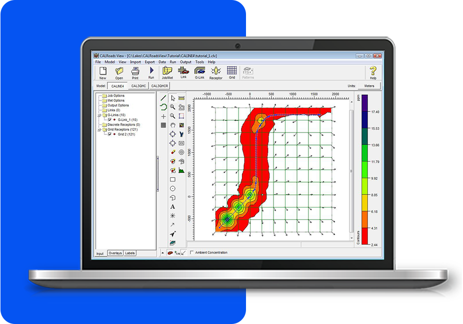
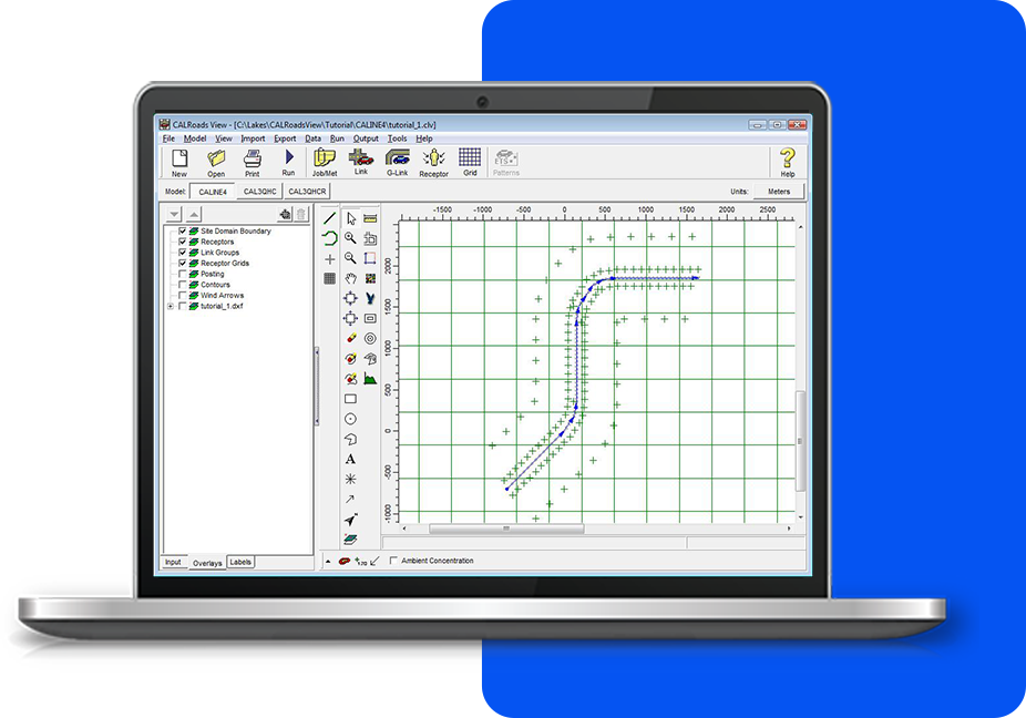
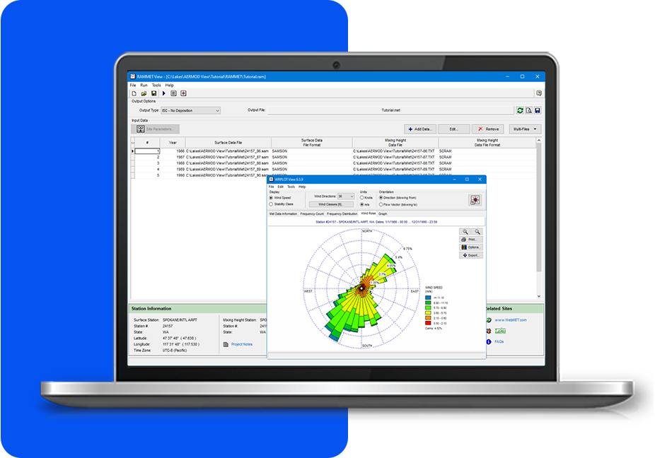
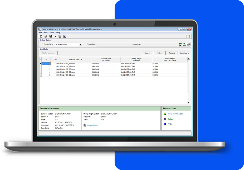
CALRoads View enables precise modeling of free-flow traffic, intersections, parking lots, and street canyons for comprehensive air quality assessments. It allows for the simulation of various traffic patterns, capturing emissions from different roadway types and urban environments. Additionally, the software offers flexible receptor configurations, including grids, discrete points, and receptors along roadways. This versatility makes it ideal for analyzing diverse traffic and environmental scenarios.

CALROADS VIEW

Additional Features

CALRoads View offers more than just an intuitive interface. Every copy comes fully equipped with all the tools you need to complete your project—no need for expensive add-ons.

Graphical Post-Processing

A wide range of contouring options and controls make it easy to present your results just the way you want them.

Windrose Visualization

Create customized windrose plots using WRPLOT View. Change colors, petal size, and more.

Input Utilities

Use a variety of input wizards to quickly and easily add all of your project data – links, receptors, emissions, etc.
MODELING TIPS

Latest Software Tips

Unlock the full potential of your environmental software with expert guidance. These tips will help you streamline processes, improve accuracy, and maximize efficiency in every project.