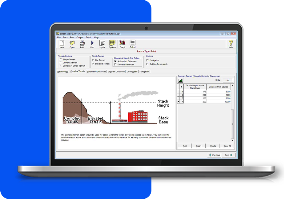
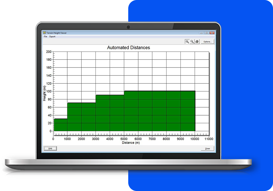
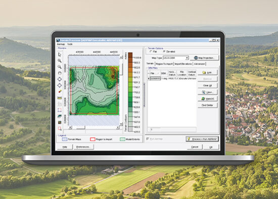
Includes a Terrain Height Viewer that offers various options for visualizing complex terrain. It allows users to easily view and analyze the terrain data they input. Both automated and discrete distances can be displayed, providing flexibility in how terrain is represented. This tool enhances the understanding of terrain impacts in environmental modeling.