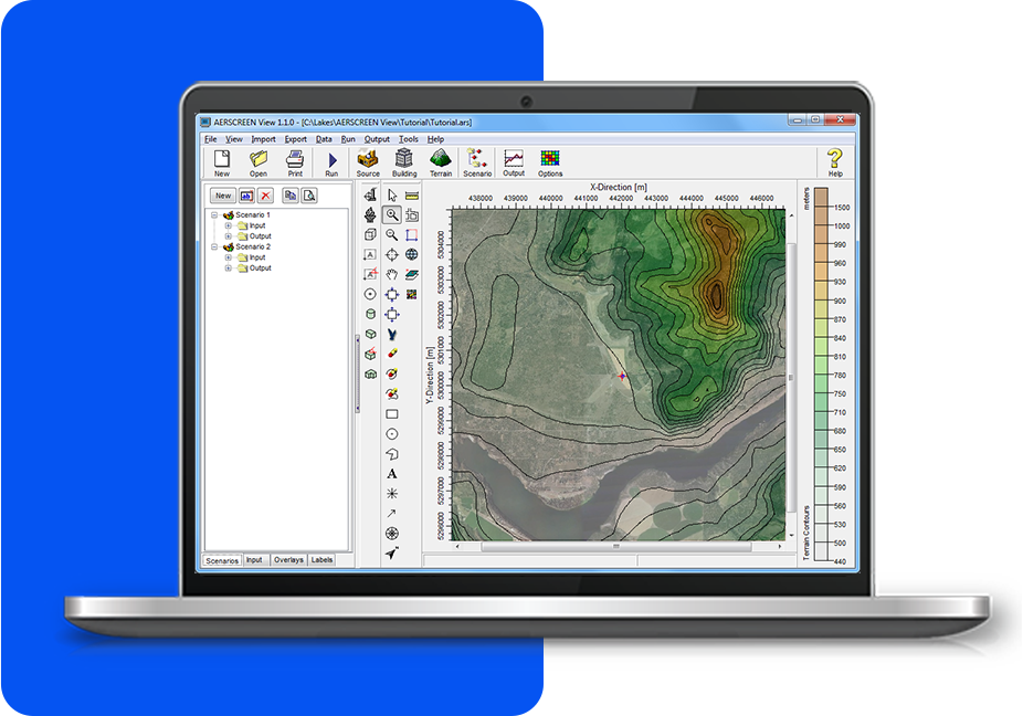
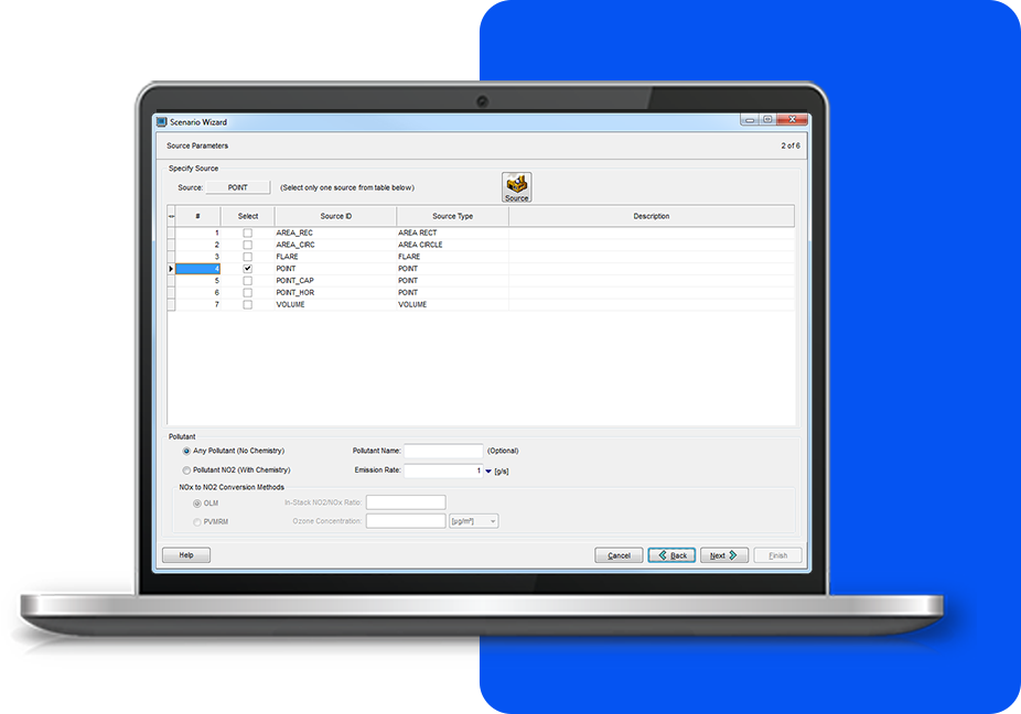
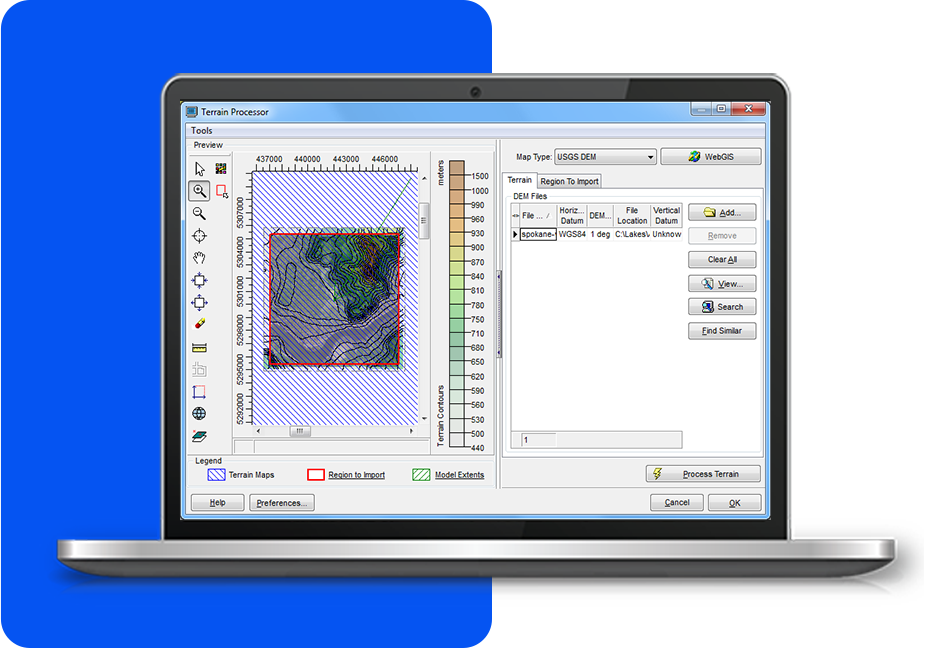
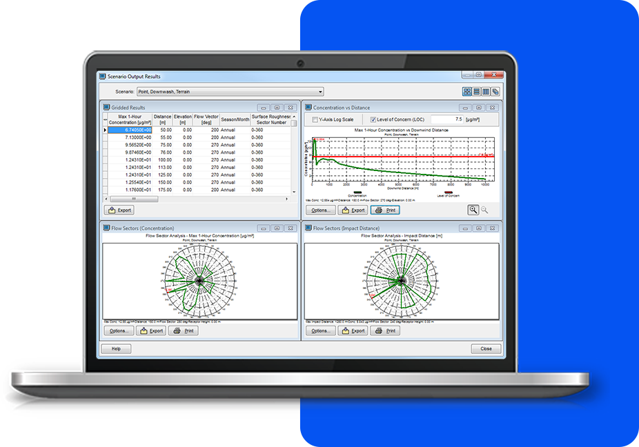
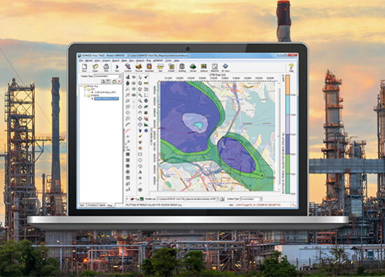
Features

Screening Air Dispersion Model for AERMOD

KEY FEATURES

AERSCREEN View contains features developed by meteorologists and engineers who regularly work with air dispersion models, so they understand what today's modeler needs to do their job successfully.


Integrated Graphical User Interface

Fully integrated interface combining easy to use graphical tools (e.g., sources, buildings), model run batcher, and advanced output display.


Scenario Wizard

Allows you to quickly and easily set up modeling scenarios in AERSCREEN View. Data blocks are intuitively grouped for simple data entry. Incorporate downwash, terrain effects, meteorological options, and more with ease.


Terrain Processor with Automatic Downloads

Advanced terrain processing capabilities are offered for several terrain data file formats such as NED, SRTM, and USGS DEM. Automated download of terrain data files from webGIS. SRTM3 terrain data at 90 m resolution is available worldwide.


Advanced Output Viewer

Review output from each scenario as text output files, tabular concentration data, and fully-customizable output graphics are available for you to analyze and interpret.

ADDITIONAL FEATURES


There is more to AERSCREEN View than great looks. Each copy contains everything you'll need to complete your project without paying for costly add-ons.

Scenario Wizard

Allows you to quickly and easily set up modeling scenarios in AERSCREEN View. Data blocks are intuitively grouped for simple data entry. Incorporate downwash, terrain effects, meteorological options, and more with ease.

Data Tree Display

AERSCREEN View stores all scenarios in a convenient data tree display for easy access. You can create new scenarios, copy existing ones, and quickly analyze multiple output files with the click of a mouse.


Model Run Batcher

AERSCREEN View automatically creates and processes input files via the Model Run Batcher. With AERSCREEN View, you can run multiple scenarios simultaneously saving you valuable time.

Seamless Model Integration

Includes all of the Fortran programs necessary to complete your analysis: BPIP (building downwash), AERMAP (terrain processing), MAKEMET (meteorology data), and AERMOD (dispersion analysis).