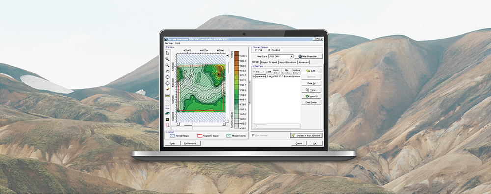
AERMAP is the terrain preprocessor program for incorporating terrain elements into air dispersion modeling analyses conducted using the AERMOD dispersion modeling system. Natively, AERMAP reads two types of terrain data:
- United States Geological Survey (USGS) National Elevation Dataset (NED) files in GeoTIFF image format
- USGS Digital Elevation Model (DEM) tiles in ASCII format
Because these formats are primarily regionalized to cover the United States, Lakes Software has added support for several other terrain file formats so that global users have multiple options for processing elevations. Coupled with the WebGIS automated data download feature, AERMOD View users have access to free, high-resolution data regardless of their location.
USGS Digital Elevation Model (DEM) tiles in ASCII format
Because these formats are primarily regionalized to cover the United States, Lakes Software has added support for several other terrain file formats so that global users have multiple options for processing elevations. Coupled with the WebGIS automated data download feature, AERMOD View users have access to free, high-resolution data regardless of their location.
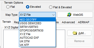
AERMOD View’s List of Supported Terrain File Formats.
One unique terrain file format supported by AERMOD View is a simple XYZ File. This file format provides users the opportunity to import custom elevations that would be otherwise difficult to incorporate into the model. This could include areas where elevations have been modified or are not adequately represented using other formats due to recent changes.
Below are a few tips and instructions on the use of XYZ files in the Terrain Processor.
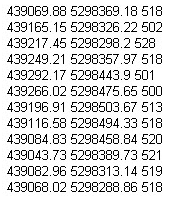
XYZ Formatting
XYZ files can be comma or space delimited, and they should be organized in Column and Row format.
- The first column must contain the X coordinate of the point.
- The second column must contain the Y coordinate of the point.
- The third column must contain the terrain elevation for the specified location.
- Each row must contain only one point.
- Units can be meters or kilometers.
When using XYZ files, note that the file must cover the entire extents to be processed with AERMAP.
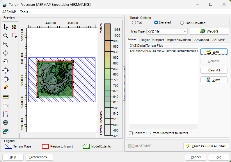
Sample XYZ File in AERMOD View’s Terrain Processor
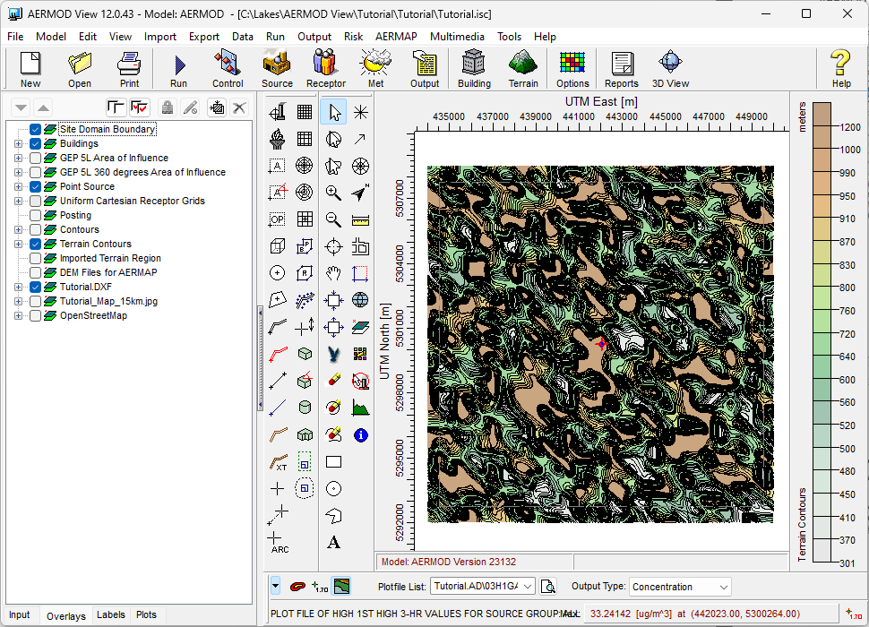
Upon successful completion of AERMAP, the Terrain Contours will be shown in the main display of the application.