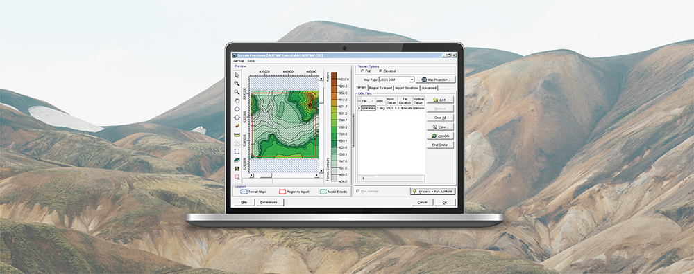
AERMAP is the US EPA’s terrain preprocessor for the AERMOD modeling system. AERMAP reads digital terrain data (e.g., USGS 3DEP [formerly NED] digital elevation models in GeoTIFF format) and calculates base elevations for sources and receptors and hill height scale factors for receptors. An integral part of executing AERMAP is identifying the files which will cover the modeling domain and satisfy these calculations.
The modeling domain is the geographic extent that includes all the sources and receptors specified in an AERMOD modeling project. At a minimum, modelers must include digital terrain files which cover the modeling domain. AERMAP will fail to run if any portion of the domain is not bounded by a digital terrain file. In addition, AERMAP expects the modeler to define a large enough terrain extent to properly calculate hill height scale.
Existing guidance from the US EPA is to set the terrain extents so that any terrain feature that is above a line extending out from any receptor with a 10% slope is included in the terrain extents. This is illustrated in the below figure. In that example, terrain feature 1 extends above the 10% slope and must be included in the terrain extents. This slope line would need to be considered for all receptors in all directions.

When modeling with AERMOD View, the Terrain Processor makes it easy to add and process terrain data. The Terrain Processor includes a Preview window for identifying the modeling domain (Model Extents) and terrain extents (Terrain Maps).
AERMAP allows the user to set the domain to be processed. In the Terrain Processor, this is handled via the AERMAP tab in the AERMAP Domain Options group box.
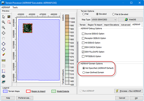
There are two options:
- Not Specified: This is the default option and it reads the entire extents of the specified Terrain Maps
- User-Defined: Limits AERMAP’s calculations to domain extents defined by Region to Import
One way to utilize the User-Defined domain is to set the Region to Import to avoid prominent terrain features (e.g., tall mountain peaks) which would influence hill height scale values beyond a reasonable range of influence. It also serves to reduce AERMAP runtimes when processing very large terrain files.