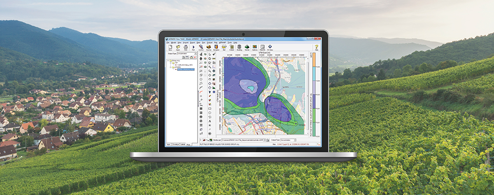
AERSURFACE is a non-regulatory component of the AERMOD air dispersion modeling system. The tool reads digital land cover data and objectively calculates surface characteristics for input to the AERMET meteorological preprocessor. Input to AERSURFACE comes from the USGS National Land Cover Database (NLCD) distributed through the Multi-Resolution Land Cover Consortium (MRLC).
Near the end of 2024, USGS announced a major shift in the NLCD project with the release of the Annual NLCD Collection 1.0 for the continental United States (CONUS). Legacy NLCD products were released approximately every 3-5 years, but the Annual NLCD project includes data products for every year from 1985-2023.
The U.S. EPA updated the AERSURFACE tool to version 24142 on November 20, 2024. One of the major updates to AERSURFACE was the flexibility to read all product years of the new Annual NLCD project. Using Annual NLCD data helps generate more precise surface characteristics by accounting for land cover variability on an annual basis.
To aid modelers in their use of AERSURFACE, AERMET View Version 13.0 includes enhanced land cover data downloads in its AERSURFACE Utility via WebGIS. Follow the steps below to take advantage of the new WebGIS offerings:
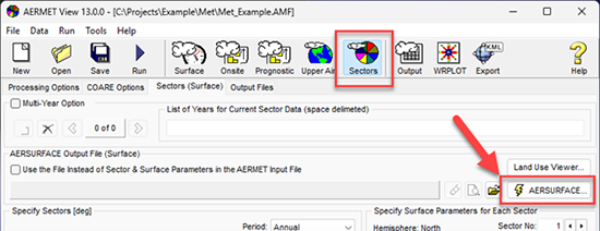
Step 1. Open the AERSURFACE Utility in AERMET View.
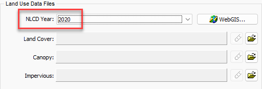
Step 2. In the Land Use Data Files group, select the year of interest from the NLCD Year drop-down menu. In the example below, the year 2020 is used.
Step 3. Press the WebGIS button (![]() ). The utility will automatically download available NLCD data products for the selected year and project location.
). The utility will automatically download available NLCD data products for the selected year and project location.
WebGIS is designed to follow current U.S. EPA guidance for selection of data products. This means that WebGIS will only download all three data products – Land Cover, Percent Tree Canopy, and Percent Impervious – when all three are available. With Version 13.0, this includes the years 2011-2021 based on limited availability of Canopy data. For the years 2022 & 2023, WebGIS will download Land Cover only.
Data from older years can be accessed via the MRLC website and inserted manually into the AERSURFACE Utility.