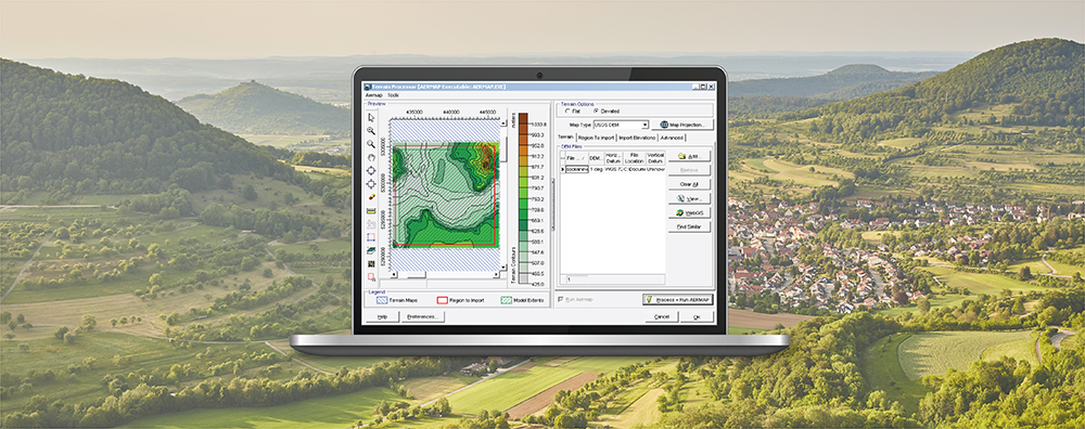
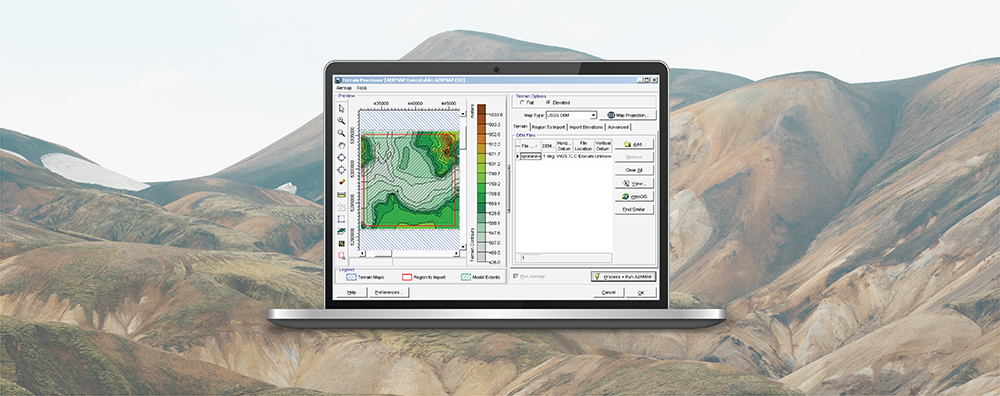
1-170 Columbia St. W

Modeling Tips

  • December 18, 2023

AERMOD View: Import Elevations from AERMAP

AERMAP is the terrain preprocessor for the AERMOD modeling system and provides data to AERMOD necessary for dispersion calculations in complex terrain. AERMAP reads digital terrain files, interpolates elevations for most model objects, and calculates hill-height scaling factor for receptors in an air dispersion study conducted using AERMOD.

  • November 23, 2023

U.S. EPA Conference on Air Quality Modeling

Earlier this month, the U.S. EPA hosted the 13th Conference on Air Quality Modeling at their offices in Research Triangle Park, North Carolina. This month’s Modeling Tip takes a closer look at why this Conference is held and what gets accomplished.

  • October 26, 2023

CALPUFF View: New Ranked Values Grid View

Last month’s tip discussed the new Top-50 Table Viewer, one of the new additions to CALPUFF View Version 10.0 which aids modelers in visualizing output from the CALPOST postprocessor. Another addition to this release of CALPUFF View is the Ranked Values Grid View.

  • September 21, 2023

CALPUFF View: New Top 50 Table Viewer

Last month’s tip discussed the new Top-50 Table Viewer, one of the new additions to CALPUFF View Version 10.0 which aids modelers in visualizing output from the CALPOST postprocessor. Another addition to this release of CALPUFF View is the Ranked Values Grid View.

  • August 17, 2023

AERMOD View: Access Graphical Output Options via Contours Panel

When conducting an air dispersion modeling analysis, modelers may want to know not just what the value of the maximum concentration is but also how frequently concentrations exceed some upper limit or threshold. The U.S. EPA AERMOD air dispersion model comes with an option to extract these exceedances: the Threshold Violation File or MAXIFILE. Lakes Software’s AERMOD View application goes a step further and automatically counts those exceedances so that modelers can easily determine the frequency of such violations.

  • July 19, 2023

AERMOD View: Batcher Utility

When conducting an air dispersion modeling analysis, modelers may want to know not just what the value of the maximum concentration is but also how frequently concentrations exceed some upper limit or threshold. The U.S. EPA AERMOD air dispersion model comes with an option to extract these exceedances: the Threshold Violation File or MAXIFILE. Lakes Software’s AERMOD View application goes a step further and automatically counts those exceedances so that modelers can easily determine the frequency of such violations.